Author Archives: Dennis Ghiglieri

About Dennis Ghiglieri

My concern for the Truckee River grew over the years. It started with picking up trash and supporting better water quality. I helped create the "living river"plan with other citizens on the Community Flood Coalition; a plan to reduce flood impacts to infrastructure through river restoration and protection of the floodplain. I understand how critical the Truckee River is to the environment – and economy – of our entire region. I'm hoping that through these pages we can all understand our connection to the Truckee River and why we need to protect it.

Lake Tahoe rises above its rim

Storm over Lake Tahoe

Late in the evening on April 9 during a sub-tropical storm system producing mostly rain and showers in California and Nevada, Lake Tahoe once again went above its rim and connects to the Truckee River at Tahoe City. The Lake has been below its rim since fall of 2014. The Lake has risen more than 1.5 feet since its low in the late fall of 2015. How high will the Lake rise? That will depend on how fast the snow melts and whether or not we receive additional rain and snow this spring.

Tahoe rises above its rim late evening of April 9, 2016

Tahoe rises above its rim late evening of April 9, 2016

Drought-busting El Niño for western Nevada? Not so much.

Lake Tahoe during a winter storm

California news outlets report that the April 1, 2016 snow surveys show that the snowpack is running slightly above to slightly below average in the northern and central Sierra Nevada and decreasing to around 75% as you move southward along the range. Southern California and southern Nevada and Arizona have below average snowpacks reported by the California Resource Agency and the US National Resource Conservation Service for April 1, 2016.

Scientists with the Desert Research Institute say this result is opposite of what would be expected for an El Niño year where more precipitation should occur in the southwestern US – southern Nevada, Arizona, and southern California – and drier conditions to the north – Washington and Oregon. (See  winter forecast article from last fall.)  Winter 2015-16 saw precipitation trending higher in the Pacific northwest including northwest California instead. Why? Scientists do not currently have an explanation for the switch. Most snowpacks, however, are just at or below average in many north western locations.

Great climate weather maps can be found at gbdash.dri.edu.

Great climate weather maps can be found at gbdash.dri.edu.

The trend did produce an average water year with a less than stellar snowpack on April 1 in the Truckee River watershed in both the Sierra Nevada and Carson Range west of Reno and around Lake Tahoe. As I write this, Lake Tahoe is still about 1.5 inches below its rim, but rising as the snowpack melts under very warm spring conditions. Flow for the Truckee River this year is likely to be below the long-term average, though, because the entire Truckee River watershed has been in deficit over the last 16 years. Currently, the Truckee River is flowing at around 800-900 cubic feet per second (CFS). However, 300 CFS is diverted away from Pyramid Lake reducing flow to Pyramid to 500-600 CFS. Pyramid’s large water deficit over the past 16 years is likely to continue in 2016.

At the April 5, 2016 Climate Forum, scientists talked about the anomalous nature of precipitation for this year’s El Niño. However, El Niño did produce warmer conditions as would be expected. This winter was overall very warm and the departure from the long-term average temperatures continues up which is in keeping with global temperature rises.

Lake Tahoe weekly elevation ending April 8 2016

Lake Tahoe weekly elevation ending April 8 2016

In a brief presentation on the region’s climate looking to the future, Dr. Kelly Redmond from the Desert Research Institute, explained that as of now humans have added 25% more CO2 to the atmosphere and that the CO2 will remain in the atmosphere for a long time – one or two millennia. It is simple physics that CO2 has changed the heat balance of the atmosphere and that more heat is being retained now and will continue until a new, warmer overall equilibrium for the earth’s atmosphere is reached.  Other scientists said warmer conditions also lead to increased evaporation and evapotranspiration by plants. Even if precipitation remains the same, warmer temperatures mean less water will be available for rivers and streams and groundwater recharge as a result.

At the Climate Forum Dr. Benjamin Hatchett from UNR discussed long-term drought that occurred in the past.  Droughts lasting 240 and 140 years occurred between 832 – 1299. Are we prepared for such events should they occur again?  Clearly the late 19th and 20th centuries produced more average precipitation for the west than the beginning of the 21st century has so far. Could a “mega-drought” be in our near-term future? Climate models are not showing a huge swing downward in precipitation, but warmer temperatures will exacerbate droughts. How can we as a society do a better job of using water in both good and poor water years?  Can we adapt to warmer conditions and still maintain the environment? Truckee River flows? Pyramid Lake? Area streams and springs? Forests?

There seems little doubt that warmer conditions alone will require a much more thoughtful approach to water use if we expect future Nevadans to enjoy a healthy Truckee River and sustained Pyramid Lake and Lake Tahoe.

Winter snow with a barely flowing Truckee River through downtown Reno at Lake Street Bridge during the TROA Celebration.

Winter snow with a barely flowing Truckee River through downtown Reno at Lake Street Bridge during the TROA Celebration.

Snowpack survey due April 1 – Reno & Carson Range get late March snow

Spring snow blankets Reno March 28, 2016

Soon the NRCS (US Natural Resource Conservation Service) will do the April 1 snow survey.  That survey – generally the last one for the 2015-16 season will undoubtedly be much improved over the last one for the 2014-2015 winter season. However, is it a drought busting winter? Not too likely at this point.  Will it be above or below average or just average?  Stay tuned for the report.

Meanwhile, a much appreciated, surprise “inside slider” snow storm dropped as much as 10 inches of snow in Reno and along the east side (predominately) of the Carson Range and Sierra. Without the rain shadow of the Sierra, Reno got just as much snow as much higher mountain locations.

Drought Monitor for March 22, 2016 shows significant drought remaining in western Nevada and California.

Drought Monitor for March 22, 2016 shows significant drought remaining in western Nevada and California.

This winter season has been unusual in that the much predicted above normal precipitation for the southwestern US largely did not materialize (at least yet). Currently, the drought monitor still shows significant drought conditions for the southwestern portion of the country.

One average – or even above average – winter season doesn’t make up for the severe deficits built up in the Truckee River basin during the last 4 years and the deficit created in Truckee River flows over the last 16 years of mostly drought conditions. The southwest US drought started in 2000 and has continued with only 2 above average precipitation years. The final survey for the 2015-2016 winter season for the Truckee River watershed may come close to average or better, but the entire southwest US is unlikely to see an end of the long drought.

One good thing; the late snowstorm will likely delay the start of Truckee Meadows residents cranking up their sprinkler systems. TMWA (Truckee Meadows Water Authority, water provider for the region), however, seems poised to declare the drought over.

Water pours into the gutter from excessive watering in August 2014.

Water pours into the gutter from excessive watering in August 2014.

Keeping water conservation in place would be a far better approach and making sure the groundwater areas that TMWA pumps from recover fully before dropping conservation measures. It is far too early to pretend drought for the Truckee River has ended.

Spring arrives after a so-so winter for western Nevada

Truckee River in Feb. 2016 from John Champion Park bridge in Reno.

In western Nevada and the Sierra to the east of the crest, It did snow; it did rain; there were some cold nights; the snowpack was above average; the snowpack was below average; now with spring here and March two-thirds history, how the snowpack will finish is “up-in-the-air”.

The Truckee River is flowing much more than last year at this time, but with Lake Tahoe still below its rim, it is unlikely that this will be a banner year for Truckee River flows. A very dry February threw cold water on hopes for a double or triple snowpack year. Could that change?  It will depend on whether it rains and snows a lot more into the spring.  So far, most of the storms in March have been much bigger on the west side of the Sierra than on the east, but have helped restore some of the lost Truckee River watershed’s snowpack after a dry February.

As of today, Lake Tahoe’s elevation stands at 6,222.72 and rising as snow melt kicks in. That’s a big gain from Dec. 9, 2015 when the Lake’s elevation was 6,221.37. Tahoe’s rise of 1.35 feet over the winter represents 54 billion gallons of water. That 54 billion gallons, however, merely fills a huge water deficit and isn’t water that represents flow to the Truckee River; and Tahoe needs another 11 billion gallons to repay the deficit so that water can once again reach the Truckee River at Tahoe City.

Truckee River downtown

Truckee River downtown

Pyramid Lake, however, has continued to fall in elevation dropping more than a foot since October 1, 2015 to the last measurement on March 1, 2016.  Continual Truckee River diversions to Lahontan Reservoir are a significant factor in the loss of water for Pyramid Lake, the natural outflow for the Truckee River.

According to USA Today, “[t]he U.S. saw its warmest winter on record – a whopping 4.6 degrees above average.”

Reuters reports, “The rate of carbon emissions is higher than at any time in fossil records stretching back 66 million years to the age of the dinosaurs, according to a study on Monday that sounds an alarm about risks to nature from man-made global warming.”

Warmer temperatures mean more evaporation and more water use to grow crops and water lawns.  More carbon in the atmosphere means ever more warming.

For the moment, however, we see a flowing Truckee River and will still hope for a good spring runoff, fish spawning from Pyramid Lake into the Truckee, and water for kayacking and swimming in the river during the summer. It might even keep snowing into April, right?

Panorama of Truckee River Whitewater and Wingfield Parks in Downtown Reno
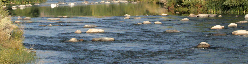
Panorama of Truckee River Whitewater and Wingfield Parks in Downtown Reno


TROA is good for urban Washoe County; problems remain to keep Truckee River system healthy

The Derby Dam diverts Truckee River water from its natural course which goes to Pyramid Lake. Instead water flows into the Truckee Canal to the Carson River.

The TROA (Truckee River Operating Agreement) took 27 years to be finished and lawsuits against the Agreement (actually completed in 2008) settled or withdrawn. Now that the celebrations are done and TROA is implemented, what are the benefits to the over all health of the Truckee River?

Mark Foree, Executive Director of TMWA, announcing the purchase of Donner Lake Water Rights.

Mark Foree, Executive Director of TMWA, announcing the purchase of Donner Lake Water Rights.

Water purchases for water quality to increase water in the Truckee River below Derby Dam for the benefit of Pyramid Lake are certainly a benefit; although the amount of water flow is relatively small, it improves the river’s health during periods of lower flow. Also, changes in the timing of water delivery to water rights holders to benefit riparian forest regeneration is a good thing for the River.

The benefits for the urban portions of Washoe County served by TMWA (Truckee Meadows Water Authority)  are very tangible – storage for drought supply in up-stream reservoirs and water exchanges between reservoirs to benefit water supply. This allows TMWA to call for more water during periods of drought to help meet its overall water rights to support urban and suburban customers.

Nevertheless, the majority of water rights owned on the Truckee River benefits urban uses and farmers in the Carson River negatively impacting the urban portion of the river and the areas below Vista.

The Derby Dam diverts Truckee River water from its natural course which goes to Pyramid Lake. Instead water flows into the Truckee Canal to the Carson River.

The Derby Dam diverts Truckee River water away from its natural course which flows to Pyramid Lake. The dam diverts a significant amount of the Truckee River into the Truckee Canal to Lahontan Reservoir on the Carson River.

Are we going to have a healthy and vibrant river system including the Truckee River’s unique inland sea – Pyramid Lake?  Stay tuned and we’ll be discussing the challenges facing the entire Truckee River system in the coming weeks.