Author Archives: Dennis Ghiglieri

About Dennis Ghiglieri

My concern for the Truckee River grew over the years. It started with picking up trash and supporting better water quality. I helped create the "living river"plan with other citizens on the Community Flood Coalition; a plan to reduce flood impacts to infrastructure through river restoration and protection of the floodplain. I understand how critical the Truckee River is to the environment – and economy – of our entire region. I'm hoping that through these pages we can all understand our connection to the Truckee River and why we need to protect it.

2014 Temps in California and Nevada highest since record keeping began

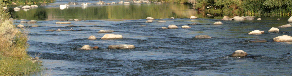
Truckee River in downtown Reno trickles under the Virginia Street Bridge in late 2014.

As if you hadn’t already noticed, it was warm in 2014 – the year that just slipped into history 10 days ago.  Two stories summarized the findings of recent scientific analyses of the state of the climate in 2014. One focusing on California is found in SFGATE.COM and another focusing on Nevada and Reno is found in RGJ.COM.

The Highland Ditch which supplies irrigation water to Rancho San Rafael Regional Park is dry in late summer 2014 because the Truckee River doesn't have enough water to support any diversions in the Truckee Meadows.

The Highland Ditch which supplies irrigation water to Rancho San Rafael Regional Park is dry in late summer 2014 because the Truckee River doesn’t have enough water to support any diversions in the Truckee Meadows.

Briefly, scientists are reporting that 2014 average temperatures in California were 4 degrees (fahrenheit) higher that the 20th century average and that 7 of the 10 hottest years in the Golden State have occurred since 1994.  As goes California, so goes Nevada where 2014 average temperatures were 3.6 degrees higher than the 20th century average.  Reno saw average temperatures 1 degree warmer than the record set in 2012. Warm temperatures coupled with drought are a bad combination for both states now facing a long dryer-than-normal period of more than 14 years.

The U.S. also saw its 18th consecutive year where average temperatures exceeded the average temperatures for the 20th century.

The revelations about the high temperatures should be alarming, but mostly the reports about the warm (and continually warming) temperatures here and elsewhere in the northern, northern hemisphere are ignored by most. Certainly too many legislators and governors openly scoff at the reports and ignore calls to slow down the trend by limiting greenhouse gases.  Government scientists who undertake the studies that underpin the reports of warming are frequently pooh poohed by talking heads from Fox to PBS.  Scientists have looked at ways to reduce greenhouse gases and slow or (unlikely now) reverse the warming.

How does warming effect the Lake-Tahoe-Truckee-River-Pyramid-Lake system?  For one thing, it increases evaporation – significant since the Truckee River includes 2 large lakes which collectively evaporate several hundred thousand acre-feet of water each year.  Warming temperatures also increase the amount of water plants need in everything from urban landscaping to farming potentially reducing recharge to groundwater and lowering flows in streams.  We are very likely already seeing effects from warming in increases in evaporation and evapotranspiration loss.

Truckee River is reduced to a trickle after the Glendale Water Treatment facility takes on water from the river just above the bridge.

Truckee River is reduced to a trickle after the Glendale Water Treatment facility takes on water from the river just above the bridge.

As I’ve mentioned before, we are still hoping for a miracle series of large Pacific storm systems to save us from the drought.  If, however, the drought is of our own making – however unwittingly – that may be a false hope.


Deer, minks, and more along the Truckee

Mink foraging along the Truckee River near Rock Park at sunset January 2015

Wildlife live along the Truckee River all the way out to Pyramid Lake. Bears have even wandered down the river to Pyramid Lake communities several years back.  Didn’t see anything quite so exotic this weekend, but it is always a delight to find wild animals along the Truckee.

This sleek and resourceful predator lives along the river and is frequently seen throughout the Truckee Meadows.

Mink foraging along the Truckee River near Rock Park at sunset January 2015

Mink foraging along the Truckee River near Rock Park at sunset January 2015

The North American Mink is found in most areas of the continent except the desert southwest to Texas.  This one was foraging along the Truckee River near Rock Park.

Deer are pretty common along the river, too.  This guy was lounging at University Farm along with his 2 buddies and several doe.

Deer lounging at University Farm just south of the Truckee River.

Deer lounging at University Farm just south of the Truckee River.

Winter is a special time to see waterfowl that the rest of the year you’d only see in northern Alaska or Canada.  Here is a male Common Goldeneye floating on the Truckee above Idlewild Park.

Common Goldeneye duck on the Truckee River near Idlewild Park, Reno

Common Goldeneye duck on the Truckee River near Idlewild Park, Reno

Wildlife viewing along the river is always good in the winter.  Get out there and enjoy the river.

American Dipper in the Truckee

American Dipper at Idlewild Park in Reno January 3, 2015

Ever see a small dark bird bouncing on rocks then diving into the water in the Truckee?  Most likely you’ve spied an American Dipper called by some a water ouzel.  Dippers are quick to disappear on their dives and can reappear elsewhere in the stream with amazing speed.

Today we took a walk along the river at Idlewild Park and were happy to spend some time watching a dipper doing its bouncing dance along the rocks (and ice) in the river.  Dippers have been known to nest under bridges in downtown Reno.  They are commonly seen also at Mayberry Park.  They can be found year round, but easier to see, I think, in the winter.  Here is a short video showing their typical behavior.

Normal drought or climate-change drought?

The snow pack for the Truckee River and Lake Tahoe is below normal for the end of December– again.  The Reno Gazette-Journal reported the Truckee River basin snowpack at 67% and the Lake Tahoe snowpack at 44% of “normal”.  December and January are usually the heavy lifters when it comes to providing the bulk of the moisture collected in the Sierra Nevada.  What the rest of the winter has in store for us remains an unknown.

Scientists at Woods Hole Oceanographic Institution and the University of Minnesota reported December 4, 2014 that the current California Drought is the worst in 1,200 years (at least).  The scientists analyzed growth rings on Blue Oaks growing in California to reach that conclusion and implicate human-caused climate change as the reason.  While droughts have always occurred, the current one is worse because of both increased temperature as well as decreased precipitation.

An icy Truckee River flows into Pyramid Lake on New Years Day 2015.  Pyramid Lake levels have fallen dramatically since 2000.

An icy Truckee River flows into Pyramid Lake on New Years Day 2015. Pyramid Lake levels have fallen dramatically since 2000.

Forbes published yesterday an article “No doubt it’s a climate-change drought, scientists say” quoting Jonathan Overpeck with the Institute of the Environment at the University of Arizona saying, “Of course everyone knows California’s drought has been for three years, rain so far has been helpful, there’s a snowpack in the Sierra Nevada’s that is about 50 percent of normal thanks to recent precipitation, but that hasn’t stopped the drought. The drought is still going to be the story at the end of the year, I think.”  He went on to say, ““To frame the drought we should be mentioning that much of the southwest and west has been in drought now for nearly 15 years, since 1999…”

While many in Nevada (and California) are hopeful that this year will see a turn-around and we’ll see above normal winter snows by the 1st of April, the last 15 years should give us pause for expecting that the drought will simply end and everything will return to “normal” in the long-run.  Climate change is the new dragon in the room.

December 30, 2014 Drought Monitor Map

December 30, 2014 Drought Monitor Map

WOW? Wind on Water effect?

Lake Tahoe Storm at Sand Harbor

We had some very high winds in the last storm in the mountains and apparently at Lake Tahoe, too. (BTW, the storm didn’t do diddly squat here in Reno and not much for the Truckee River either as far as I can tell, but more on that later).

High winds actually brought out surfers to Lake Tahoe and a photo in the RGJ showed them on their boards during the high winds (you’ll have to look around in the current story a bit to find the photo).

I’m wondering if those strong winds aren’t responsible for the interesting graph of Tahoe’s water elevation that the USGS collects near Tahoe City, CA.  First you see a very big increase in the level of the water level (2.4″ rise), followed by a sharp decrease of the water level by an even greater amount, then followed by a slower rise of more than an inch and then a gradual decrease.  Could it be that water is being pushed by the wind?  Then rolling back as the wind slacks off?  I’d be interested to hear from experts on this topic.

Lake Tahoe 'bathtub' effect from strong wind?

Lake Tahoe ‘bathtub’ effect from strong winds on December 11, 2014?